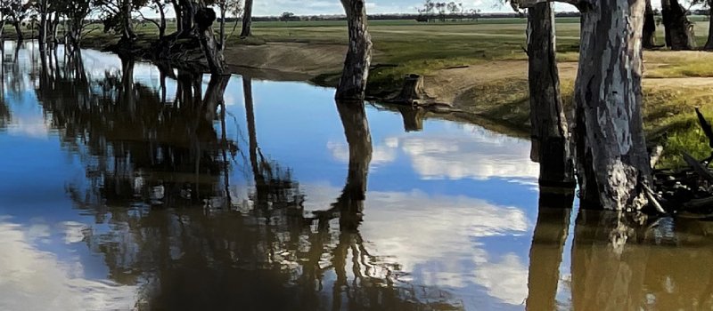
Work underway along Tuppal Creek
Works have begun on the Mid-Murray Anabranches Project with 6 new single span bridges being installed along Tuppal Creek.
About the project
Part of the NSW Government’s Sustainable Diversion Limit Adjustment Mechanism (SDLAM) program, the Mid-Murray Anabranches Project aims to restore the quality and functionality of local rivers and creeks within the Murray River system, and support the needs of adjacent landholders, industries and First Nations communities.
The project will improve connectivity between the Murray River, its main anabranch, the Edward-Kolety river system, and surrounding creeks including Tuppal, Native Dog and Bullatale creeks by December 2026.
Investment in local infrastructure will deliver ecological outcomes for these important waterways by improving river flows to support river health and by removing barriers to fish movement.
The project will allow water for the environment to be delivered more flexibly, so the objectives of the Murray-Lower Darling Long-Term Water Plan and Basin-wide Environmental Watering Strategy can be achieved.
The needs of landholders along the creeks will also be supported by the establishment of fit-for-purpose infrastructure, including the installation of clear-span bridges and new rock crossings for land access.
Project benefits
The project will provide a range of benefits for landholders, communities and the environment such as:
- improving the connectivity between the Murray and Edward-Kolety rivers
- increasing native fish passage and ecological production
- supporting the accessibility and management requirements of private landholders
- increasing tourism and industry opportunities in the area (i.e., recreational fishing and birdwatching)
- enhancing wildlife habitat for a range of animals, including the nationally threatened superb parrot
- improving First Nations people’s Connection-to-Country.
Project status
Work is underway to construct 6 single-span bridges on properties along Tuppal Creek. The pre-cast concrete bridges will provide improved connectivity throughout the creek system to support river health and improve fish passage, while also allowing landholders to maintain land access during targeted watering events. The Tuppal and Warragoon communities will see increased traffic, including trucks and light vehicles, along local roads between Tuppal and Deniliquin while construction is underway. Construction of the bridges is expected to be completed by the end of 2025.
The detailed design process is also well progressed for the Bullatale Creek and Native Dog Creek works packages.
Consultation with affected landowners and other key stakeholders is ongoing.
Project location
The Mid-Murray anabranches are located in southern New South Wales near Deniliquin. They form the northern boundary of the Murray River floodplain and the eastern boundary of the Edward-Kolety River floodplain.

Stakeholder engagement
The Water Group values input from its stakeholders and communities, including First Nations communities, and is committed to comprehensive engagement with real and tangible outcomes. We have been working directly with affected communities to understand what needs to be done to deliver the project effectively, while minimising local impacts.
Negotiations with landholders to address access and stock security requirements are progressing towards contract negotiations for infrastructure works.
Completion of the project by December 2026 will mean a significant investment in infrastructure with flow-on benefits for communities and businesses. The program will prioritise local contractors to ensure, wherever possible, investment flows back into local communities.
Environmental planning and assessments
View the project's Environmental Planning and Assessment Regulation [Clause 171(4)] publications.
Report
Review of Environmental Factors: Mid-Murray Anabranches Project – Native Dog Creek Crossings.
Report
Review of Environmental Factors: Mid-Murray Anabranches Project – Bullatale Creek Crossings.
Report
Addendum Review of Environmental Factors: Tuppal Creek Restoration Project Roadway Crossings Works.
Subscribe for updates
Sign-up for updates about SDLAM projects.
Contact us
For more information call us on 1300 081 047 or email us at water.enquiries@dcceew.nsw.gov.au